The Legacy of London’s Cartographers: Honoring the Art and Science of Mapping
Celebrating the Legacy of London’s Cartographers: The Art and Science of Mapping
Explore the rich history of cartography in London, highlighting the contributions of renowned cartographers and the impact of their work on the city’s development.
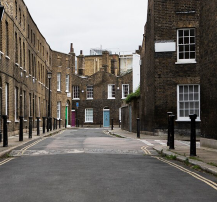
Cartography, the art and science of map-making, has played a pivotal role in shaping our understanding of geography and history. In a city as complex and layered as London, the contributions of skilled cartographers have been invaluable in documenting its evolution over centuries. From early hand-drawn maps to modern digital representations, the legacy of London’s cartographers is rich and varied. This blog will explore the history of cartography in London, the notable figures behind the maps, and the impact of their work on the city’s development, with insights from the London Topographical Society (LTS).
The Historical Context of Cartography in London
The origins of cartography in London can be traced back to the medieval period when maps were primarily created for religious and political purposes. These early maps often focused on significant landmarks, such as churches and castles, reflecting the power dynamics of the time. As London grew and transformed, the need for more detailed and accurate maps became apparent.
The Renaissance marked a turning point in cartography, as advances in science and technology led to more precise surveying techniques and the introduction of new mapping tools. During this period, London’s cartographers began to produce maps that not only served practical purposes but also showcased artistic elements, making them valuable historical documents.
Notable Cartographers and Their Contributions
Richard of Cirencester (14th Century): One of the earliest known cartographers to document London, Richard of Cirencester created a map that illustrated the city’s layout during the medieval period. His work laid the groundwork for future cartographers and provided insights into the urban landscape of London at the time.
John Stow (16th Century): Stow was a historian and antiquarian who produced one of the first comprehensive maps of London. His work, “A Survey of London,” published in 1598, included detailed descriptions of the city’s streets, buildings, and notable landmarks. Stow’s map was instrumental in documenting the city’s growth and development during the Elizabethan era.
Agas (1561): The Agas Map is one of the most famous early maps of London, providing a detailed depiction of the city during the Elizabethan period. This map is notable for its artistic illustrations and its representation of the River Thames, streets, and key buildings. The Agas Map remains a vital resource for historians and researchers studying the city’s past.
John Rocque (18th Century): Rocque’s map, published in 1746, is one of the most detailed maps of London from the 18th century. His meticulous work captured the city’s layout, including streets, parks, and significant buildings. Rocque’s map is celebrated for its accuracy and detail, making it an essential resource for urban studies.
Charles Booth (1889): Booth’s poverty map is a groundbreaking work that visually represented the socio-economic conditions of different neighborhoods in London. By color-coding areas based on income levels, Booth provided valuable insights into urban poverty and inequality. His map remains a crucial resource for social historians and urban planners.
The Artistry of Cartography
Cartography is not only a technical discipline but also an art form. The creation of maps requires a delicate balance of aesthetics and functionality, as cartographers strive to present information in a visually engaging manner while ensuring accuracy. The artistry of cartography is evident in the intricate details, decorative elements, and creative designs found in historical maps.
London’s cartographers often infused their maps with artistic flourishes, reflecting the cultural context of their time. For example, the Agas Map features illustrations of notable buildings, ships on the Thames, and scenes of daily life, inviting viewers to explore the story behind the geography. This artistic approach enhances the narrative of the map, making it more than just a tool for navigation.
The Impact of Cartography on Urban Development
The work of cartographers has had a profound impact on the development of London. Maps have served as essential tools for urban planning, helping policymakers and city planners visualize the layout of the city and make informed decisions about infrastructure, transportation, and land use.
Historical maps also provide valuable insights into the socio-economic conditions of different neighborhoods, highlighting patterns of growth, migration, and change. By analyzing these maps, researchers and historians can uncover the factors that have shaped London’s urban landscape over time.
Moreover, cartography has played a crucial role in preserving the city’s history. As neighborhoods change and evolve, historical maps serve as records of what once was, allowing future generations to understand the context of their surroundings.
The Role of the London Topographical Society
The London Topographical Society is dedicated to preserving and promoting the art and science of cartography as it relates to London’s history. Through its extensive collection of historical maps, publications, and scholarly research, the LTS provides invaluable resources for researchers, historians, and the public.
Membership in the Society offers numerous benefits, including access to exclusive publications featuring historical maps, discounts on past publications, and invitations to events that celebrate London’s cartographic heritage. The Society’s annual general meeting and newsletters keep members informed about the latest research and developments in the field of London history and cartography.
Additionally, the LTS organizes lectures and exhibitions that highlight the artistry and significance of historical mapping. These events provide opportunities for members and the public to engage with experts in the field, fostering discussions about the relevance of cartography in understanding urban history.
Conclusion
The legacy of London’s cartographers is a rich tapestry of artistry, science, and historical significance. Through their work, these skilled individuals have documented the city’s evolution, providing invaluable insights into its geography, culture, and socio-economic conditions. The London Topographical Society plays a vital role in preserving this legacy, ensuring that the contributions of cartographers are recognized and celebrated.
Whether you are a historian, a student, or simply someone with a passion for London’s history, engaging with the art and science of cartography offers a unique opportunity to connect with the city’s rich heritage. Join the London Topographical Society today and embark on a journey through the fascinating world of cartography, exploring the maps that have shaped our understanding of one of the world’s most iconic cities.
To further explore London’s architectural history, check out this article on The Evolution of London’s Architecture: A Journey Through Time and discover more resources on London’s architectural landmarks.